|
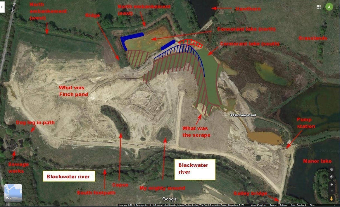
I haven't stepped foot on site for four weeks, and two weeks since Inert switched back to the infill of Cormorant lake. I held off for the past two weeks as I felt that progress was slow, there being few lorries around when I did my mid week jaunts. However, I have said that the 20-30 minutes I spend walking around the edge of Manor farm mid week is not a true representation on the rate of infill or of the number of lorries transporting stuff per day. Well, it looks as if Inert and contracted lorry drivers have been working hard. Much progress has been made with the infill of the north shore of Cormorant lake (south). The mud flats, along the north shore of Cormorant lake (south), have almost completely been covered over. Only a thin sliver for drainage of Cormorant lake (north) separates the land mass and the northern part of manor farm. The infill extends eastward to stop, currently, some 10 or 15metres shy of the east shore mud flats. I guess (ho, ho, famous last words) that Inert will extend the infill a little more east, before turning their attention south to fill in the remaining, small piece of Cormorant lake (south). What I am curious to know is if the current height of the infill is the final or finish height. It is considerably higher than the mud flats. Does this mean that infill (or upfill in this instance) will continue on to the mud flats along the east shore of Cormorant lake (south). This area is currently home to a lot of breeding species, and is an established habitat. Shame to ruin it. Then, I guess, Inert will turn their attention to landscaping the area, in particular carving out the new, elongated Manor lake, and flattening all the embankments. Inert have built a new vehicle track, allowing lorries to traverse the land mass to reach its north east corner, where the latest infill takes place. Previously, they had to still use the limestone bridge, heading north west before taking a sharp right to head east. There is, at last, a load of room for the lorry drivers to reverse, and to allow two way traffic. Finally!!! The latest infill on the map below is a pure guess. Partly as the map from google earth is quite old, and partly as I am not a map maker so don't have a very good handle on my bearings. Plus, Inert have worked on the east shore of Cormorant lake (south) and may have changed the profile from that shown in this Google earth image. Comments are closed.
|
AuthorA polite notice first: All photographs on this blog are owned by me and subject to copyright. Archives
November 2025
Categories |

 RSS Feed