|
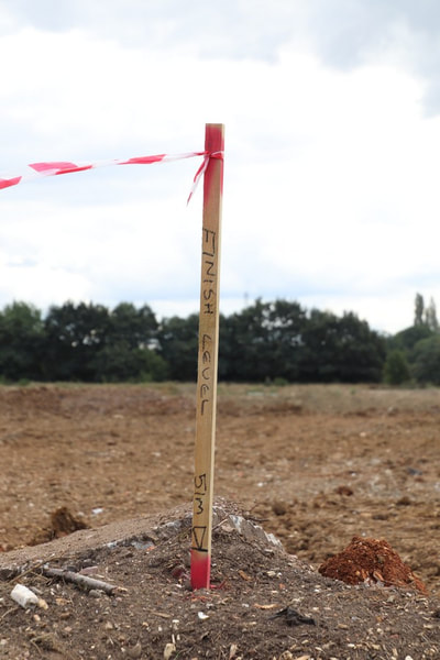
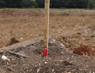
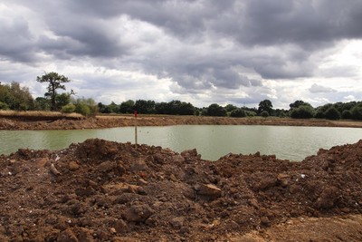
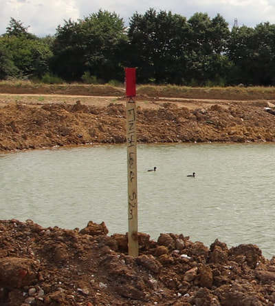
I was unable to get to Manor farm mid-week to see what was the current infill tactic. Instead I have to rely on memory as to what changes have taken place this last week. Firstly I immediately noticed a number of square poles, not unlike slender tree stakes, dotted about the site, each with a piece of red and white hazard warning tape fluttering from their tops. I couldn't decide if they were a new form of traffic control or survey marks (if that is the proper term). Most survey marks tend on construction sites tend to be in the shape of the cross of Lorain. Walking closer revealed that each had a red band, some 1"-2" (25-50mm) thick, about halfway down the stake, and one was on a pile of soil with the soil level with the band. Only when I was up close did I see the inscription "FINISH LEVEL", followed by a height in metres and a symbol i.e. a horizontal line level with the top of the red band on which rests an upside down triangle. When I got home and examined the photos, I noticed that some had the the triangle/line symbol (datum ?) on the top of the stake, and that the stake didn't have any red/white tape. These stakes were used where the infill was not yet high enough to have the symbol near the bottom of the stake. Obviously the land after infill has to be level with this mark. What I can't yet work out is if the height in metres is the depth of infill OR the resulting height of the land above sea level. I will consult my OS map, once I can find it. A quick research on t'internet suggests that Eversley Cross has a mean sea level of 60m. Finch Pond/Manor farm is a few metres above Eversley Cross. The two different types of stakes are shown in the gallery below. Judging by the stakes near the Longwater road entrance, the intention appears to be to raise the land to be almost level with the Longwater road at the entrance. This would certainly keep the proposed car park clear of all but the severest of flooding. To be fair, when the this area did flood earlier in the year, the water in Finch pond, Cormorant lake, etc didn't have anywhere to flow until Inert cut a channel to the culvert. Where upon the water flowed into Fleet Hill farm and caused flooding around the ponds there. However, the Blackwater breaches its banks there anyway. Inert have been piling up spoil during this past week to get the height of infill specified by these stakes. They have concentrated their efforts on the north east portion of Finch pond, building up quite a level of soil. Interestingly, they have left a large depression to the north west shore of Finch pond. It's sort of like an enormous sunken garden. Now, this could either be reed beds (i.e. a shallow area of the new, smaller, leaner Finch pond) or it might be the way I have seen Inert work in the past i.e. they build the edges of the subsequent infill before filling it all in. Time, as they say, will tell. They have also not taken the infill any closer to the ridge, but have simply continued to build up the eastern edge. Thus the pile of soil across the track to the cutting in the ridge is now the eastern edge of the infill, with a drop of about a metre. Though the track is now flooded as water levels continue to rise. I also noticed that work has been going on around the north side of the copse, particularly around the exit of the fragment of the Colebrook. I didn't investigate this part of the site this week or walk along the south footpath as I was busy with a family event. Finally, probably part of the surveying effort, I noticed a vehicle had been up the north embankment, and that there appears to be a curious lump of soil deposited on the west ridge next to the Longwater road entrance. This first slide show gives an indication of how much more the land will be built up around Finch pond. Remember that where I am standing, several metres of infill that has already taken place. On with the standard slide show. Comments are closed.
|
AuthorA polite notice first: All photographs on this blog are owned by me and subject to copyright. Archives
November 2025
Categories |


 RSS Feed