|
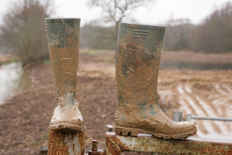
The Met office rainfall radar let me down today. It is normally great for timing a walk to miss heavy showers or rain. Not today. An expected break in the drizzle did not materialise. My Cameras were protected by highly sophisticated covers: Warburton's farmhouse bread wrappers. My DLSR and myself got a trifle damp on our stomp around the reserve. A short one this week. I retrieved my trail camera. Water levels in the Blackwater have fallen by roughly 6" (15cm). Subsequently there a fair amount of activity was caught; and not just Grey squirrels! In one sequence I thought we might have a Water vole. Alas, I suspect it was a brown rat. The camera had fired at night, and the animal was at a slightly oblique angle, making a positive identification for inexperienced old me a little difficult. It was the ears that gave the game away. I might also have caught the American mink again. Water levels in Stone Crusher pond have risen considerably since last week. This rise was caused by a new, deep drainage ditch Inert had cut from Finch pond to the culvert. Subsequently water levels in the stream through the culvert were much higher. The water levels in the ditch were quite high themselves. I could not walk through it, but had to leap across the ditch. The result of the new drainage ditch was that water levels in Finch pond and Cormorant lake (and Manor lake no doubt) had fallen by a foot (30cm) or so. I took a good look at how the Longwater road was constructed, especially as it went over the Blackwater. It is raised up quite a bit. The road from Finchampstead goes down hill quite a ways until quite close to the culvert where it goes up a bit to get over the culvert. Then some more to get over the Blackwater, before sloping down again. There would be flooding if the Blackwater and the lakes were to burst their banks. This did happen a few years ago. Inert continue to work around the pump station, yellow bridge and south shore of Finch pond. The spoil heaps of last week were arranged into long banks. This seems to be a standard modus operandii. Perhaps it is to allow even distribution of soil? Various track ways have been bulldozed, consolidating the ground and making it really easy to walk along. Deep joy not having to carefully survey my route, seeking out caterpillar tracks, and not having to test each step to see how far my wellies would sink into the mud. Perhaps the biggest change, and shock to me, was that Inert have begun to dig out the earth road north of the yellow bridge. Where last week I could walk from the yellow bridge north to the channel, this week there is a dirty great hole. Not long for the yellow bridge I fear. Firstly, before the slideshow, my long suffering wellies! This gives you an idea of the depth of mud. I was testing the depth of mud as I gingerly stepped forward, and anything deeper than what you can see without my foot encountering solid ground would entail me backing out quickly. Told you it was muddy. Comments are closed.
|
AuthorA polite notice first: All photographs on this blog are owned by me and subject to copyright. Archives
November 2025
Categories |

 RSS Feed